Reading Time: 5 minutes
Introduction.
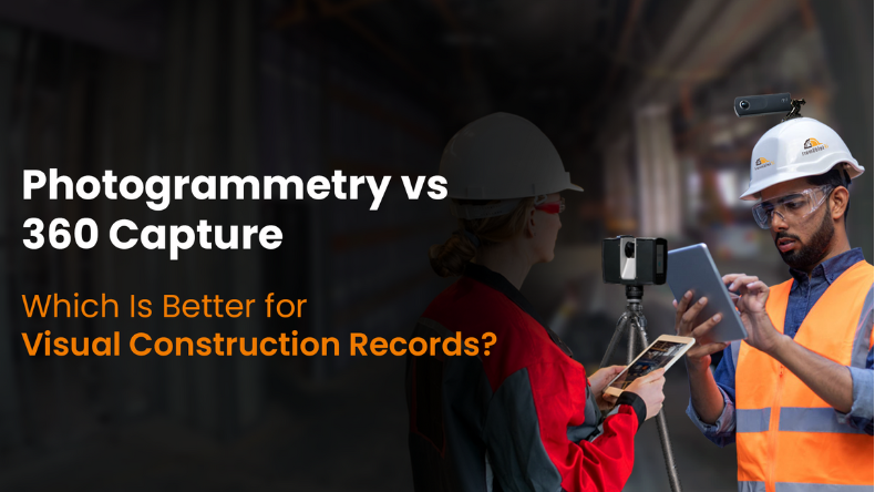
In the space of site documentation and digital construction, there are various technologies that are creating an impact. But, there are two that have transformed the way various participants document, process, and connect with visual job site information – 360-degree photos and photogrammetry. Both these processes and tools are crucial for creating virtual construction records that improve progress monitoring, enable communication, and help with quality assurance. But, each technology provides its own benefits, restrictions, and use cases that rely on precision, operational strategies, and conformity.
The following article explores a very technical comparison between 360° photo capture and photogrammetry for virtual construction records. These technologies are used to acquire and process data, generate models, enable interoperability, and create connected BIM workflows.
Work Smarter, Not Harder
iFieldSmart empowers your team with AI-driven efficiency to simplify scheduling, boost collaboration, and keep projects on track.
Schedule a MeetingWhat are these technologies?
Photogrammetry.
Photogrammetry encapsulates 3D reconstruction techniques and remote sensing that uses overlaying 2D photos from multiple angles to pull geometric and spatial information of a physical space. The photos are then processed to create point clouds, orthophotos, and meshes that are textured.
- Hardware used: Drones and Mirrorless cameras.
- Software used: Lens360, RealityCapture, ContextCapture, etc.
- Output: Orthophots, 3D mesh models, and point clouds that are georeferenced.
360° photo capture.
360° photos include the utilization of spherical panoramas and equirectangular photos that are taken from a stationary location for visualization through one shot. 360-degree images deliver an immersive experience for clients driven by simulations.
- Hardware used: Cameras like Ricoh Theta, Leica, and Insta360.
- Software used: Lens360, OpenSpace, HoloBuilder, etc.
- Output: Panoramic photos in a .jpeg and .png format and virtual tours that are navigable.
The importance of data acquisition: Speed vs accuracy.
Photogrammetry.
Photogrammetry includes overlaying various photos and planning trajectories. This technique is time-draining for larger job sites, dependent on specific lighting, calibrating cameras, and control points for GPS for geolocation and scaling.
- Needs accurate flight paths or ground-based photos.
- Driven by shadows, motion blur, and surface reflection.
- Control points that enhance spatial precision.
360° photos.
Capturing 360 photos is quick. A single person can run a site walkthrough and capture spherical panoramas at constant intervals. Each photo depicts a singular viewpoint.
- Capture the entire site context within a matter of seconds.
- It is not suitable for geometry that is dynamic, but it is a great solution for visual records.
- It includes a restricted use of geolocation unless it is reinforced by SLAM/GPS mapping platforms.
Achieving efficient processing and the required output.
Photogrammetry.
Processing workflows within photogrammetry is compute-draining and needs high-performance GPU/CPU hardware and software. The output which is achieved with photogrammetry is:
- Greater geometric detail using dense point clouds.
- Photorealistic texturing with 3D meshes.
- Uniformity in georeferencing and scale using orthomosaics.
- Utilizing tools like DEM and DSM to create elevation models.
360-degree captures.
360° photos are processed and converted into photo spheres that are easily navigable and linked based on captured spatial metadata or SLAM. Some tools offer AI-driven progress monitoring, problem tagging, and connecting with 2D drawings.
- Limitations within 3D extraction.
- Best for generating walkthroughs in 3D space.
- Utilized for time-stamping to achieve historical contrasts.
Realizing required accuracy and measurements.
Photogrammetry.
- Relative precision: +-1-3 cm depends on the Ground Sample Distance.
- Accuracy is enhanced with Ground Control Points and camera calibration.
- Supports true-to-scale measurements between various objects in virtual space.
- It is a good solution for volumetric analysis, deformation monitoring, and validating as-built documentation.
360° capture.
- It is suitable for visual documentation and not used for accurate measurements.
- Some tools may provide measurement approximation through LiDAR-driven 360-degree cameras and AI.
- It is also utilized for spatial and contextual realization, and not for dimensional 3D modeling.
Robust data storage and management.
Photogrammetry.
- Creates large sets of data – ranging from tens to hundreds to GBs for medium to large-scale project types.
- Needs strong data workflows and storage equipment.
- The output is stored in formats including .obj, .las, .rcp, etc.
360° capture.
- It offers a condensed dataset in comparison to photogrammetry.
- It is simple and easy to manage on cloud-driven tools.
- The file size includes 10 to 20 MBs based on the type of panorama.
Integrating VDC and BIM.
Photogrammetry.
- Point clouds using photogrammetry are imported into BIM software like Revit and Navisworks for:
- Improving Scan to BIM workflows.
- Achieve reality capture for progress assessment.
- Validate photos with design models.
360° Capture:
- Context-driven navigation while connected with BIM viewers.
- Can be used for RFIs, issues, and markups that are overlapped on design drawings.
- It is unable to generate parametric components or geometries in 3D models.
- It is used as a visual reference and is not suitable for validating geometries.
Comparison of use cases for Photogrammetry vs 360° photos.
| Use case | 360 photo capture | Photogrammetry |
|---|---|---|
| As-built 3D models. | Not applicable | Greater precision |
| Progress tracking. | Real-time | Lagging processing |
| Visual documents. | Immersive | Overhead |
| Communication between stakeholders. | Intuitive dashboard | Highly technical |
| Problem monitoring. | Tagging photos | Inspections |
| Quantity takeoffs. | Not applicable | Can be done from 3D models |
Heading to a closure.
As AI-driven photogrammetry and LiDAR-led 360-degree cameras are combined with cloud-based tools like iFieldSmart Technologies and Lens360, the line between these two technologies is starting to condense. As these two can integrate with reality capture, BIM software, and digital twins, it is best to combine all these technologies to enable enhanced virtual records.